News
DINOSAR and the FieldLook platform
The DINOSAR project is happy to collaborate with innovative companies working on smart farming applications. Our partner eLEAF, specialised in providing satellite-based data and services for agricultural production has set up an innovative application designed to optimise daily farm management tasks. By employing the power of satellite data and proprietary algorithms, FieldLook provides detailed insights into the health and progress of fields, helping optimize production and efficiency.
What is the FieldLook platform?
FieldLook bring all products and field measurements into one application, visible as time series data for analysis and algorithm development. This powerful tool currently includes both optical and radar-based products, and throughout the course of the project, integrated products will be added for further analysis. FieldLook combines satellite imagery with advanced algorithms to provide quantified crop parameters, offering a comprehensive view of field performance. This platform enables detailed monitoring and supports the development of innovative solutions that can eventually be utilised by clients.
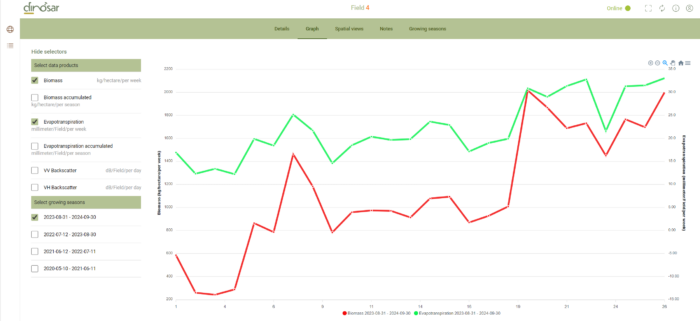
An overview of the FieldLook Platform
Why Dinosar uses FieldLook?
The aim of the DINOSAR project is to support farmers to match agricultural inputs (fertilisers, water) with what the crop needs, decreasing their environmental footprint. We are focusing on the Colombian sugarcane crops as this territory makes an excellent test case for the development of DINOSAR. The FieldLook plateform will be used to study 5 specific farms/areas in the Cauca Valley. This technology has the advantage to put all the data that farm managers need at fingertips, allowing them to:
– Monitor all the fields simultaneously from any location;
– Identify and address problem areas quickly to mitigate damage;
– Compare field performance against benchmarks for better decision-making;
– Save on input costs and increase yield through targeted interventions;
– Gain insights into crop performance and water use efficiency on farms;
– Data is available at a global scale.
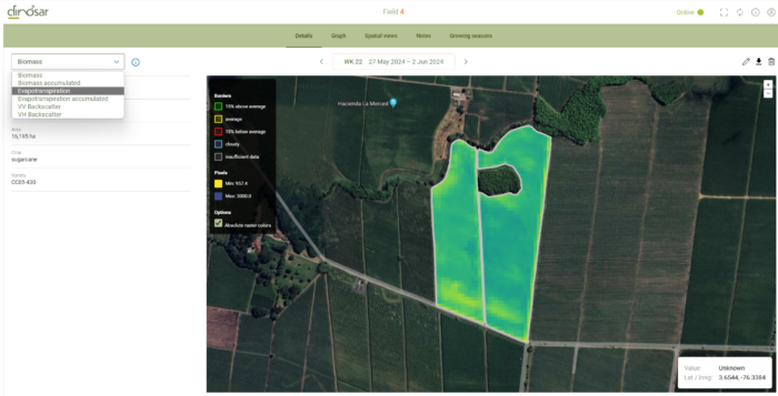
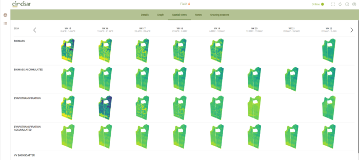
Field analysis from the FieldLook platform
Specialized Solutions for Sugarcane
FieldLook offers specialized solutions for sugarcane management. The radar-based algorithms are tailored to handle the challenges of tropical regions with heavy cloud cover. It is made to specially take into account these 3 caracteristics regarding sugarcane crops:
Cohort Tracking: Monitor and manage a single harvest cohort to ensure consistent production across different fields, soil types, or crop varieties.
Standing Cane & Yield Mapping (SCYM): Quantify current volumes of standing sugarcane and forecast harvestable volumes on future dates. This ensures optimized mill logistics and factory efficiency, reducing cut-to-crush times.
Fertilization Advice: Calculate precise fertilizer requirements based on the nutrients removed at harvest. This smart combination of satellite data and agronomic modelling ensures efficient nutrient replenishment and optimal soil health.
We look forward sharing the advances of the project with you!
Read more news about DINOSAR
Synergies with EU projects: The UDENE project joins us
After a first wave of promotion concerning the synergy between the two projects COMUNIDAD and DINOSAR, we are delighted to announce that the UDENE project is joining this initiative. The... View Article
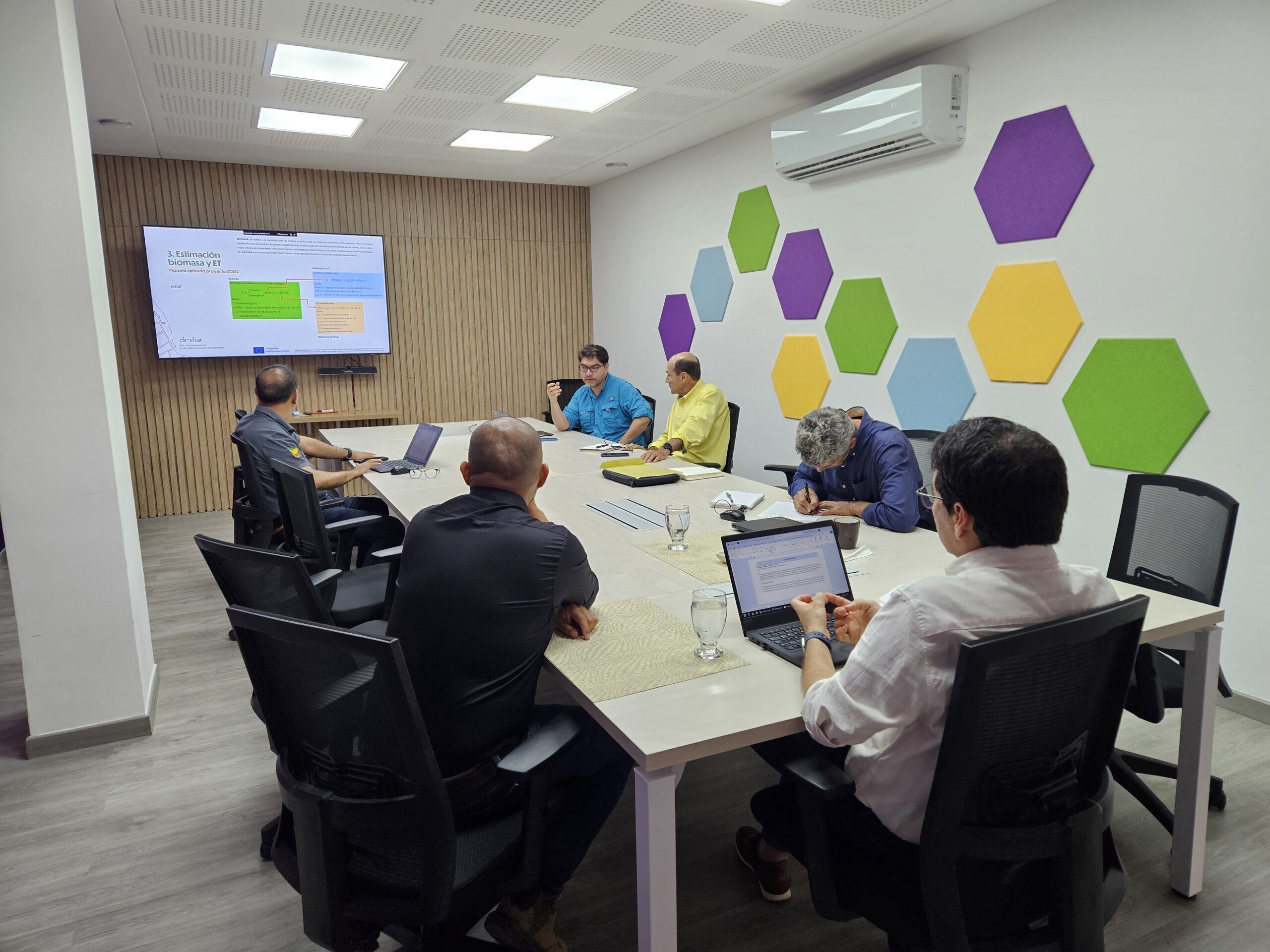
DINOSAR focuses on end-user needs
The sugarcane industry in Colombia has been a significant economic contributor since its origins in the Cauca Valley in 1900. Currently, our partner AgroAp (from Colombia) is collaborating with mills... View Article
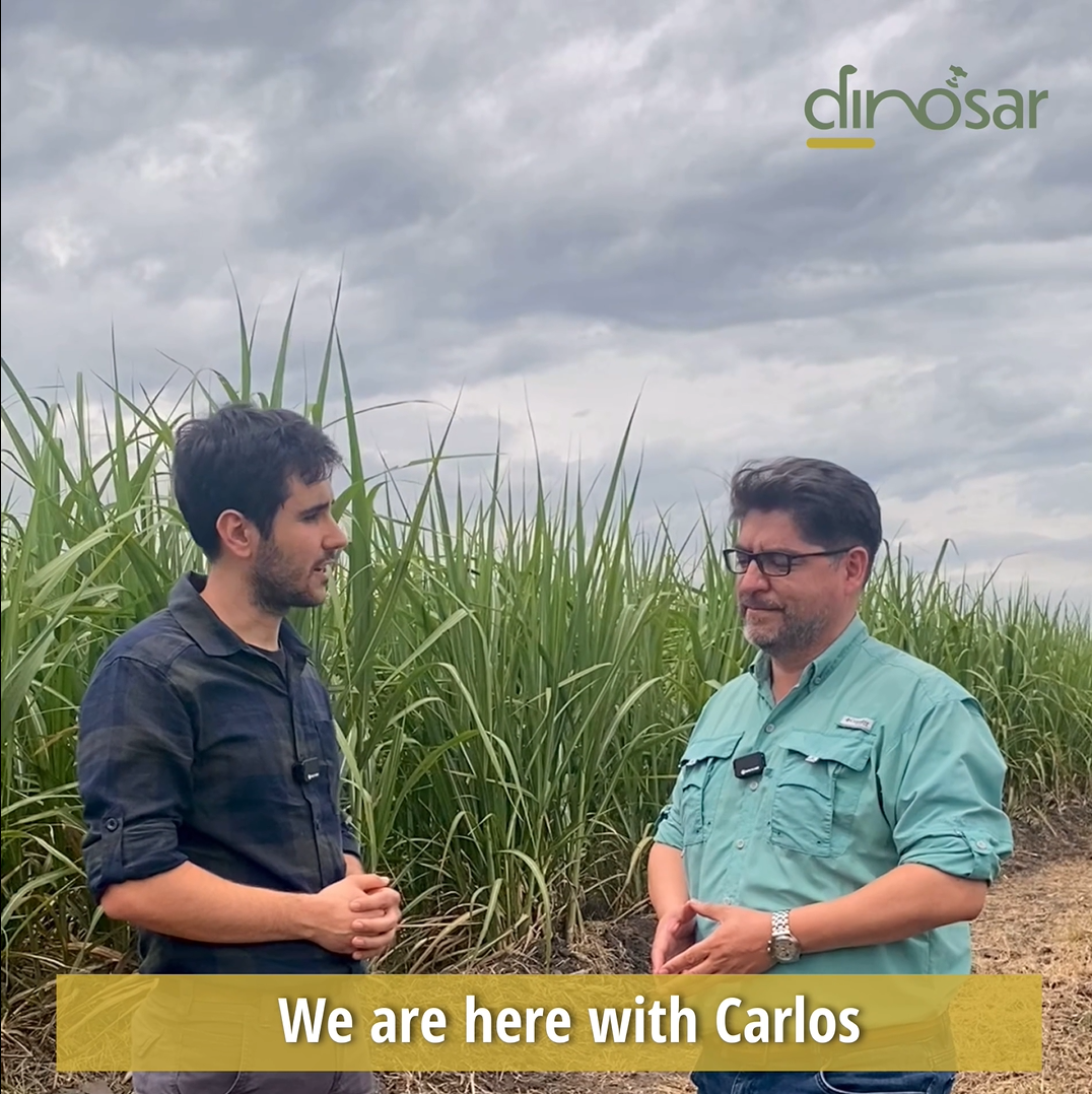
Full interview session of our partner AgroAp
In July 2024, two of our partners from the University of Alicante, Arturo Villaroya and Jiayin Luo traveled to Colombia and met Carlos Mosquera, from the company AgroAp, in the... View Article